


|
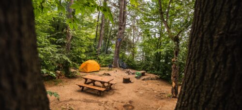
Montagne du Fort and Lac Cuillèrier area |
Open all year round |
|
Reservoir and islands sector |
Open mid-May to mid-Oct. |
-
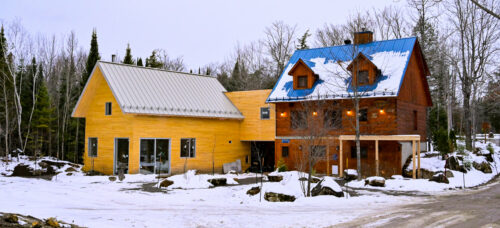
Reception - Le Bastion
-
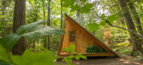
The Prisme
60 meters 1 minute by foot
-
The Grand-Héron
200 meters 2 minutes by foot
-
The Tourterelle
250 meters 4 minutes by foot
-
The Cardinal
300 meter 4 minutes by foot
-
The Pic-Flamboyant
300 meter 4 minute by foot
-
The Pic-Mineur
400 meters 5 minutes by foot
-
The Grand-Pic
400 meters 5 minutes by foot
-
1 La Cigogne
0,5 km ≈ 15 min
-
2A Le Site des Pères
2 km ≈ 40 min
-
2C La Pointe des Pères
2 km ≈ 40 min
-
3A Le Site des Mauves
1.3 km ≈ 30 min
-
3B La Pointe des Mauves
1.5 km ≈ 30 min
-
6 La Sainte Paix
1.6 km ≈ 30 min
-
12A Le Cap du Soleil Couchant
2.5 km ≈ 45 min
-
12C La Pointe aux Harles
2.5 km ≈ 45 min
-
12D La Pointe aux Cerisiers
2.5 km ≈ 45 min
-
13 Le Soleil du Midi
3.5 km ≈ 1h15
-
20 Les Pieds dans le Sable
1.6 km ≈ 30 min
-
23A L'Aurore
3 km ≈ 1h
-
23B La Pointe à Bill
3.7 km ≈ 1h15
-
24 La Pointe du Couchant
3.3 km ≈ 1h10
-
25 La Retraite
3 km ≈ 1h
-
26 La Lagune
4 km ≈ 1h20
-
27A La Canopé
4 km ≈ 1h20
-
27B La Cigale
5 km ≈ 1h30
-
29 L'Île à la Loutre
4 km ≈ 1h20
-
31 Le Paradis
4,5 km ≈ 1h30
-
34 Le Katimavik
4 km ≈ 1h20
-
36 L'Entrée du Chenal
4.9 km ≈ 1h40
-
39 La Pointe aux Bleuets
5.4 km ≈ 1h45
-
40 L'Oasis
5 km ≈ 1h30
-
41A La Pointe de Granit
6 km ≈ 2h
-

41B L'Horizon
7.5 km ≈ 2h15
-
42A La Chanterelle
6 km ≈ 2h
-
42E L'Équateur
7 km ≈ 2h
-
44A L'Enclume
9 km ≈ 3h
-
44B L'Évasion
9 km ≈ 3h
-
44C La Pointe à la Perdrix
9 km ≈ 3h
-
45A Le Parasol
9 km ≈ 3h
-
45B La Pointe aux Dorés
9 km ≈ 3h
-
47A La Pointe du Brochet
9.1 km ≈ 3h
-
47B La Terrasse
9.1 km ≈ 3h
-
47C La Pointe Ensoleillée
10 km ≈ 3h20
-
52A La Plage Cachée
11 km ≈ 3h40
-
52C Le Cap Siffleur
11 km ≈ 3h40
-
55A Le Lagon Bleu
12.5 km ≈ 4h10
-
55C Le Site de la Sand Bar
13 km ≈ 4h20
-
56 Le Rocher Fendu
13.5 km ≈ 4h30
-
59 La Pointe aux Bouleaux
15 km ≈ 5h
-
60 La Plage d'Or
14 km ≈ 4h30
-
63A Le Cap à la Tortue
15 km ≈ 5h
-
63B Le Site de la Paroi Éléphant
15.2 km ≈ 5h
-
63C La Péninsule
15.5 km ≈ 5h10
-
64 L'Île Mira
15 km ≈ 5h
-
65 L'Aube
12,5 km ≈ 4h
-
66A La Pointe aux Pins
13 km ≈ 4h20
-
66D Le Cap à l'Aigle
13.5 km ≈ 4h30
-

68 L'Île aux Voyageurs
14 km ≈ 4h30
-
70A La Petite Plage
16.4 km ≈ 5h30
-
70B La Grande Plage
16.4 km ≈ 5h30
-
70C La Pointe aux Chênes
16.2 km ≈ 5h30
-
70G La Citadelle
14 km ≈ 4h30
-
70K La Pointe de l'Épervier
16.2 km ≈ 5h20
-
72A Le Philosophe
15.2 km ≈ 5h10
-
72B L'Anse
15.5 km ≈ 5h20
-
72D La Bas-Canada
16.5 km ≈ 5h50
-
75A La Pointe Prisée
15 km ≈ 5h10
-
75B La Plage Émeraude
16.5 km ≈ 5h50
-
75C La Baie Claire
16.7 km ≈ 5h50
-
77A Le Cap des Pierres
16 km ≈ 5h30
-
77B L'Heure Dorée
16.5 km ≈ 5h40
-
80A La Destination
17.2 km ≈ 6h00
-
80B Le Banc de Sable
17.4 km ≈ 6h00
-
85A L'Île aux Patates
18.6 km ≈ 6h25
-
89 L'Île aux Grenouilles
19 km ≈ 6h40
-
90 Le Site à l'Argile
19.5 km ≈7h00
-
91B L'Île aux Géants
19.8 km ≈ 7h15
-
M1 - Le Site de la Plage
6.5 km 10 minutes by car
-
M2 - Le Camp de Base
6.7 km 10 minutes by car
-
Picnic Stop 8
2 km ≈ 40 min
-
Picnic Stop 9
2 km ≈ 40 min
-
Picnic Stop 10
2.2 km ≈ 45 min
-
Picnic Stop 12B
2.5 km ≈ 45 min
-
Picnic Stop 21
1.5 km ≈ 30 min
-
Picnic Stop 22
2 km ≈ 40 min
-
Picnic Stop 28B
3.8 km ≈ 1h20
-
Picnic Stop 30B
3.8 km ≈ 1h20
-
Picnic Stop 33C
4.5 km ≈ 1h20
-
Picnic Stop 35
4.5 km ≈ 1h20
-
Picnic Stop 38
5 km ≈ 1h40 min
-
Picnic Stop 42B
6.5 km ≈ 2h30
-
Picnic Stop 48
10.5 km ≈ 3h30
-
Picnic Stop 49
11 km ≈ 3h40 min
-
Picnic Stop 54C
12 km ≈ 4h
-
Picnic Stop 55D
13 km ≈ 4h20
-
Picnic Stop 55E
13.5 km ≈ 4h40
-
Picnic Stop 57A
14 km ≈ 5h
-
Picnic Stop 57B
14 km ≈ 5h
-
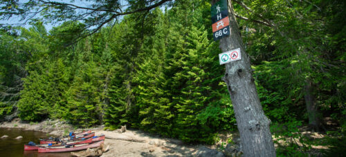
Picnic Stop 66C
14 km ≈ 5h
-
Picnic Stop 63D
15.5 km ≈ 5h20
-
Picnic Stop 72C
15.5 km ≈ 5h20
-
Picnic Stop 73A
15.5 km ≈ 5h20
-
Picnic Stop 74
15.5 km ≈ 5h20
-
Picnic Stop 78A
17 km ≈ 6h
-
Picnic Stop 80C
18 km ≈ 6h
-
Picnic Stop 85B
18.8 km ≈ 6h20
-
Picnic Stop 87
19 km ≈ 6h30
-
Picnic Stop 91A
19.8 km ≈ 6h40
-
Picnic Stop 92A
19.2 km ≈ 6h30
-
Picnic Stop 92D
20 km ≈ 6h50
-
Picnic Stop 94B
20.8 km ≈ 7h
-
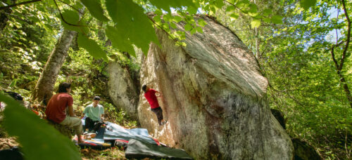
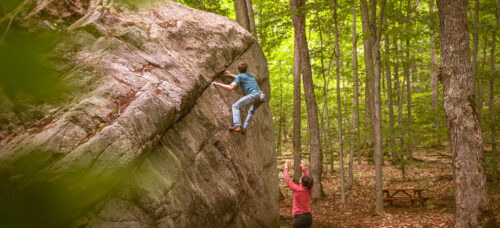
B2 Blocs des Pères
0,7 km ≈ 30 min 2 boulders 11 problems from V1 to V7-8
-
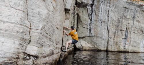
PS42 Psicobloc du Chenal
7 km ≈ 2h30 10 problems from V1 to V7-8
-
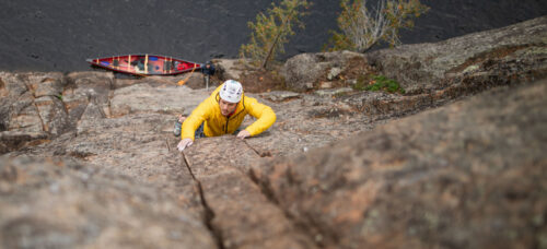
P42 Paroi Écho - Canot
7 km ≈ 2h30 32 routes from 5.6 to 5.12
-
P42 Paroi Écho - Terre-ferme
7 km ≈ 2h30 31 routes from 5.7 to 5.12
-
B44 Blocs du Chenal
7,5 km ≈ 2h45 11 problems from V1 to V9
-
P45 Paroi Amiral
9 km ≈ 3h 12 routes from 5.5 to 5.11
-
P63 Paroi Éléphant
15 km ≈ 5h 28 routes from 5.5 to 5.12
-
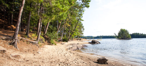
Plage du Rapide-du-Fort
5,5km
-
Sentier des Merisiers
around 1h15 Débutant
-
Sentier La Baie-Durand
around 2h30 Intermédiaire
-
Sentier Katimavik
Around 4 hours Intermédiaire
-
Sentier du Sommet
Intermédiaire
-
Sentier du Crique
around 4 hours Intermédiaire
-
Sentier du Chenal
Intermédiaire
-
Sentier le Cap du Sud
Intermédiaire
-
Sentier de l’Île en U
Intermédiaire
-
Sentier de la Paroi Éléphant
Débutant
-
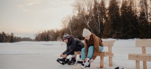
Ice Skating
100m 1 min
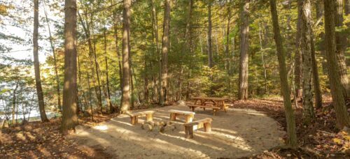
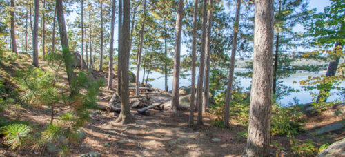
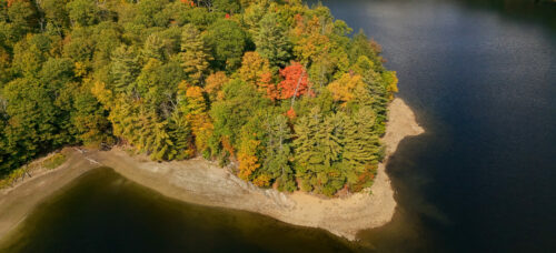
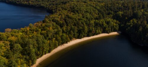
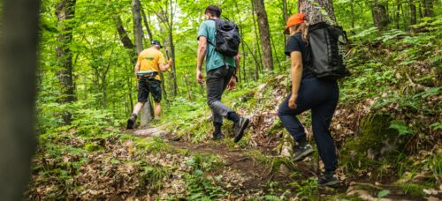
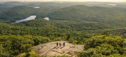
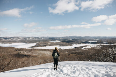
Hiking at Montagne du Fort and Lac Cuillèrier
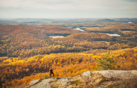
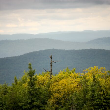
Up Here, We’re 500m Above It All
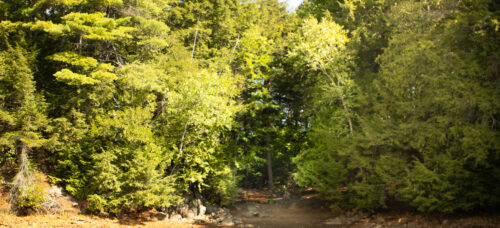
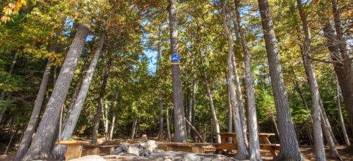
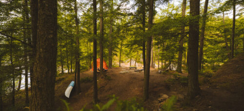
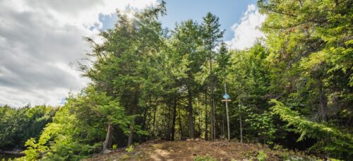
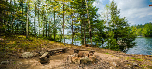
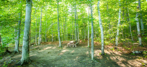
If you want to discover hiking in the Laurentides, the hiking trails of Montagne du Fort are perfect for exploring the region from all angles. The trailhead, which is accessible by car, is located at the foot of the Rapide-du-Fort sector and the Lac Cuillèrier sector. Please note that accessing these trails by non-motorized watercraft is also an option. Stop by the reception lodge to inquire about trail conditions and get a detailed map of the area.
Trail Names
- Baie-Durand
- Merisiers
- Katimavik
- Sommet
- Crique (formerly Desjardins)
Difficulty Levels
The hiking trails of the Montagne du Fort and Lac Cuillèrier sector are good for beginner, intermediate, and advanced hikers. The shortest trail that leads to a lookout is 1 km long. The longest is 5 kilometers. Now, we’re only talking about the hike in- not the return journey. Please plan your outing accordingly.
Entry and Season
- Free entry;
- Located 5 km from the reception lodge;
- Dogs on leashes are permitted;
- No entry after dark;
- Trails are open year-round, but not maintained in the winter.
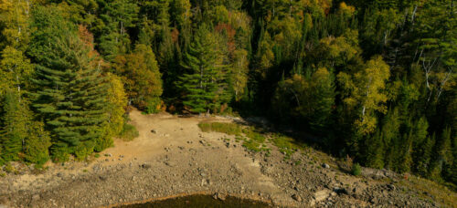
Did you know ?
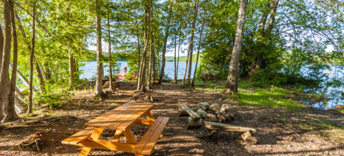
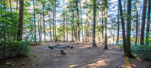
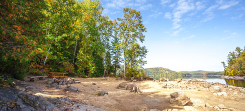
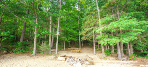
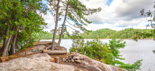
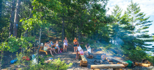
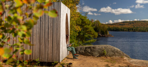
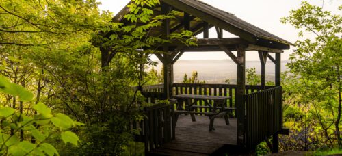
The Montagne du Fort is an impressive range in the Laurentides that has several peaks, the highest of which rises to 502 meters above sea level. Since the creation of the Park in 2008, six lookouts have been developed to offer hikers a magnificent glimpse of the Laurentians landscapes. A belvedere was built at the end of the Merisiers trail in 2008. The latter has a roof and a picnic table, and a dry pit cabinet is available near the building.


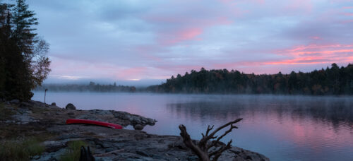
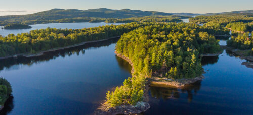
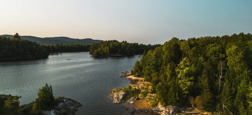
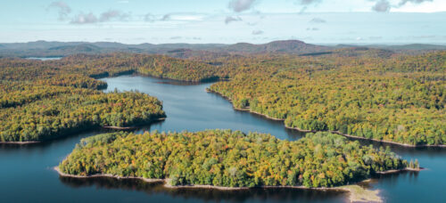
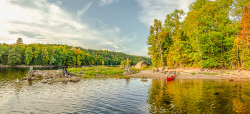
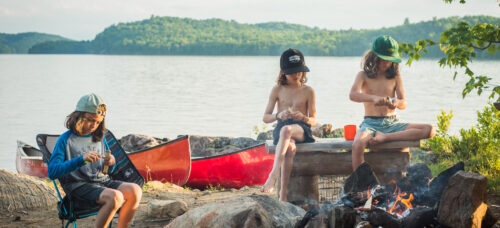
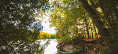
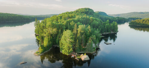
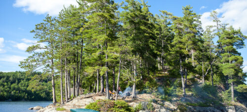
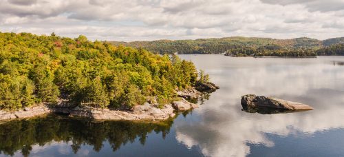
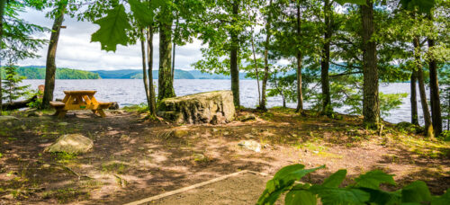
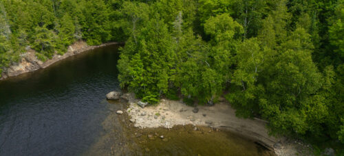
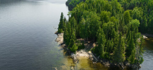
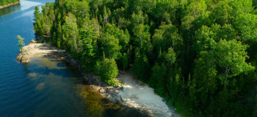
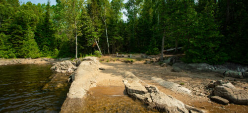
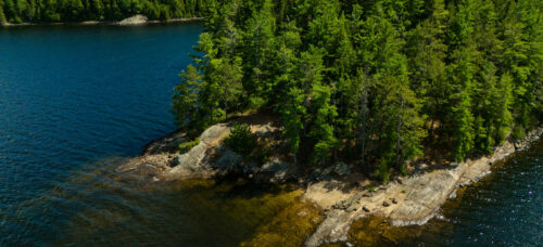
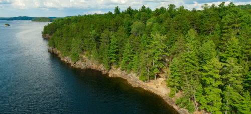
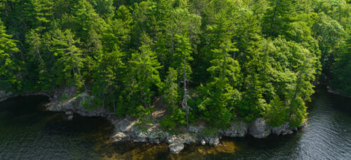
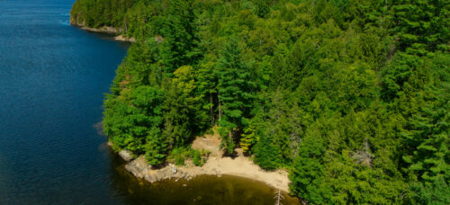
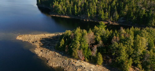
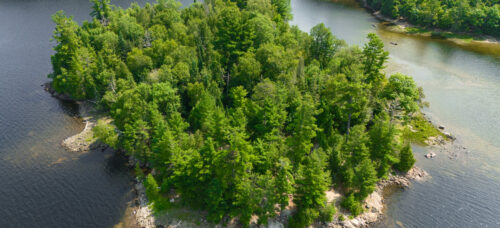
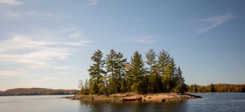
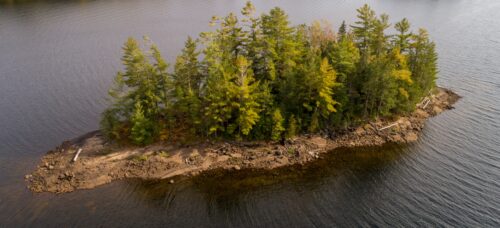
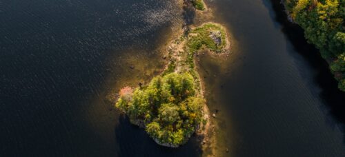
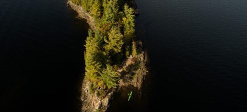
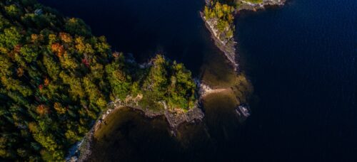
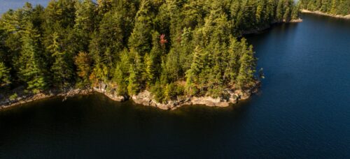
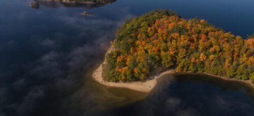
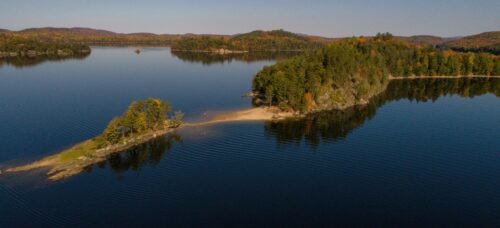
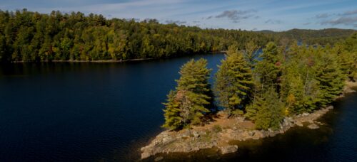
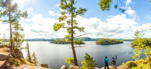
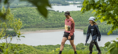
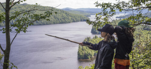
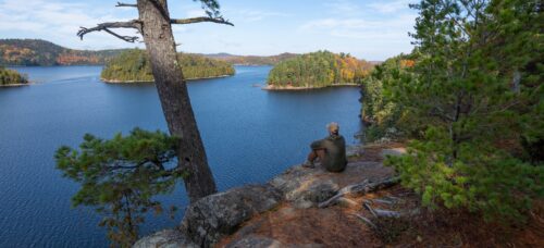
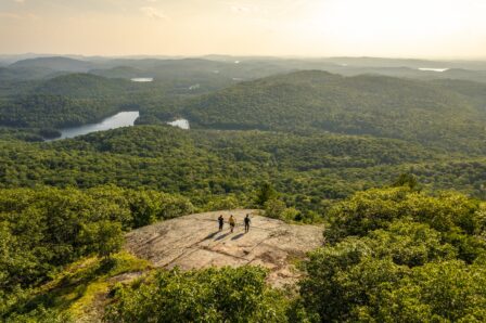
Hiking Along the Reservoir
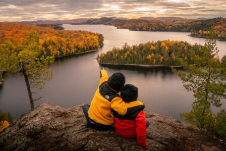
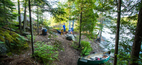
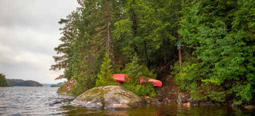
In These Parts, The Trailhead Is a Canoe
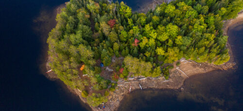
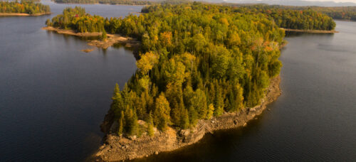
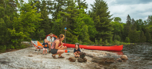
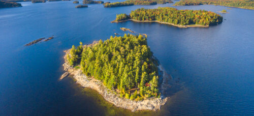
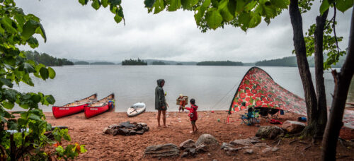
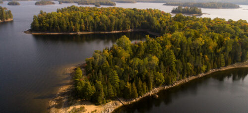
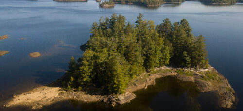
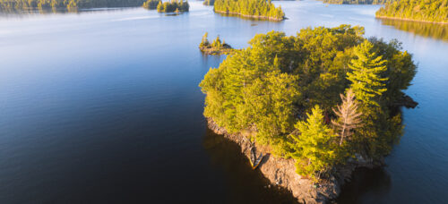
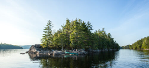
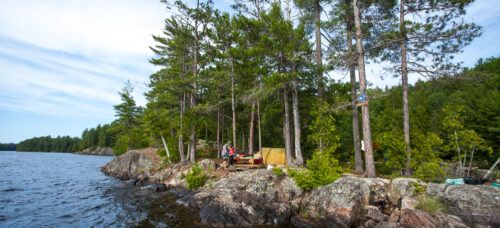
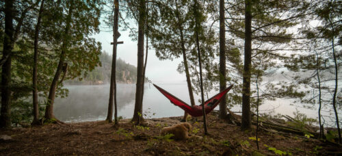
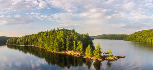
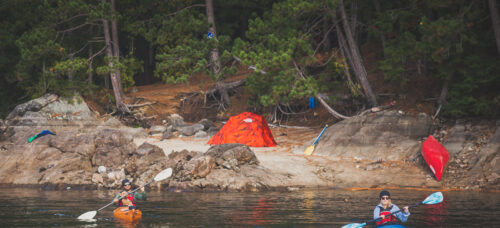
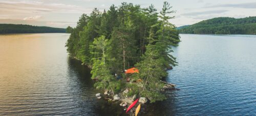
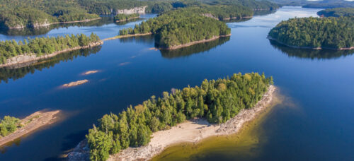
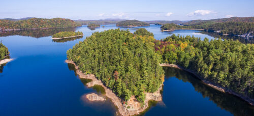
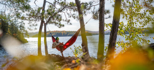
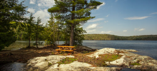
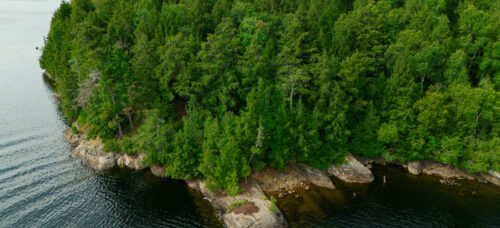
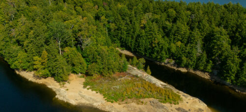
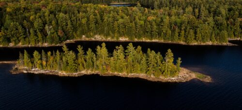
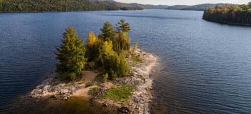
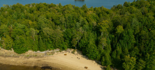
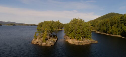
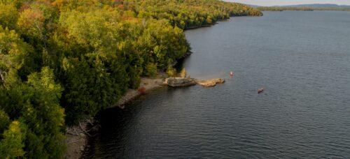
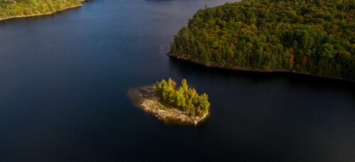
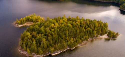
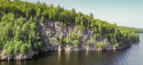
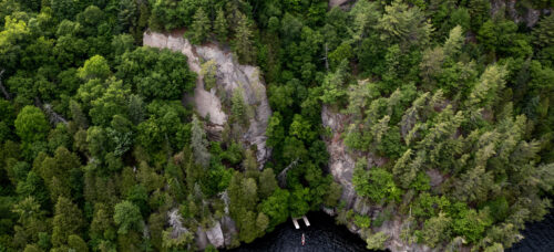
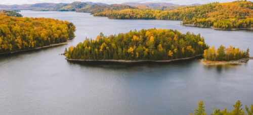
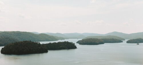
If you want to discover hiking in the Laurentides, the trails located on the islands and along the banks of the Poisson Blanc reservoir are perfect for admiring the archipelagos and, as night falls, taking in some sublime sunsets.
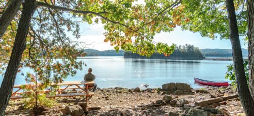
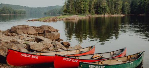
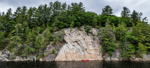
The hiking trails of the island sector are only accessible by non-motorized watercraft: there is no dock at the foot of the trails. The lookouts located at the end of each course will give you a breathtaking glimpse of the reservoir and its 100 islands, and of the hills of the Canadian Shield which border this body of water.
Trail Names
- F – Le Chenal
- G – Le Cap du Sud
- H – L’île en U
- I – La Paroi Éléphant
Difficulty Levels
The hikes around the reservoir are accessible to beginners as well as intermediate hikers. The trails are short but still have a good slope, so be prepared to work those calves.
Entry and Season
- Free entry;
- Dogs on leashes are permitted on the trails;
- No entry after dark;
- Trails are closed from mid-October to mid-May.


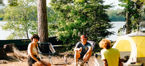
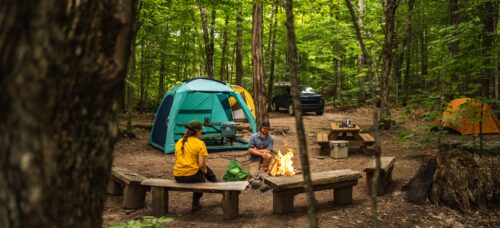
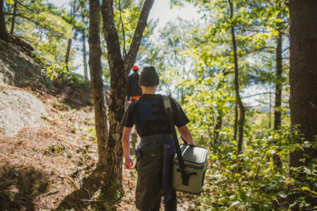
Equipment
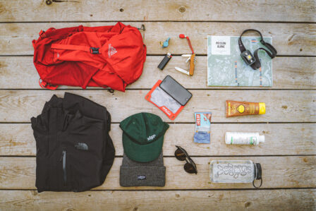
Whether you are going out for an hour or a full day, it is important to bring clothing and equipment that are suitable for hiking. Please consider:
- Checking the weather before leaving;
- Bringing at least 1.5 L of water per person;
- Wearing walking shoes that provide good support and good grip to avoid tumbling;
- Wearing a backpack for your gear: water containers, bug repellant, snacks, sunscreen, maps;
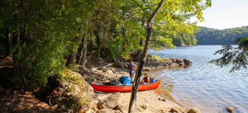
- Booking your watercraft to get to the trails located on the islands and banks of the reservoir.
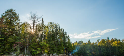
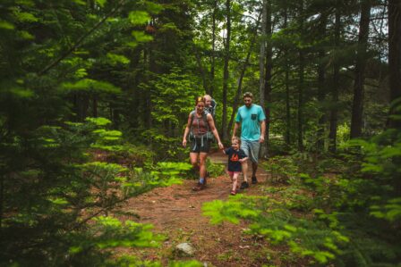
Code of Ethics for Hikers
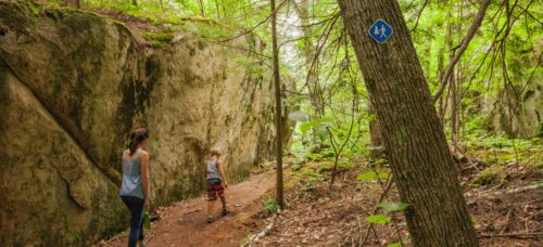
The cellular network is not always reliable on our trails. Be sure to plan a safe, autonomous outing, and to return home before dark. Courtesy is essential when hiking in the Laurentians: it is important to respect other users and trail signs, as well as the flora and fauna present in the area.
To fully enjoy your hiking experience, we encourage compliance with the Hiker’s Code of Ethics and Poisson Blanc Regional Park’s official regulations.